
Camping - Bear Creek Lake State Park - Cumberland, Virginia - June 2021
I spent a week camping at Bear Creek Lake State Park in Cumberland, Virginia about 160 miles (3 hours) northwest of Hampton Roads and about a hour west of Richmond. The park has a 40 acre lake with a boat launch, fishing pier, boat rentals, and a swimming beach. Other park amenities include a meeting facility, cabins, camping, picnicking, an archery range and playgrounds, as well as hiking trails in the park and access to the adjoining 16,000-acre Cumberland State Forest, including the 14-mile Cumberland Multi-use Trail, which is available for hiking, biking and horseback riding.
Bear Creek Lake was built in 1938 as a project of the Virginia Department of Agriculture through the State Forestry Division. This project was undertaken during the closing days of the Great Depression, however, the 100 men who built the lake were not members of the Civilian Conservation Corps. They were simply carpenters, farmers and unskilled laborers seeking jobs. The land was given to the Division of State Parks in 1940, and it was operated as a day-use recreation area. In 1962 the campgrounds were added and the area's name was changed to Bear Creek Lake State Park.
www.dcr.virginia.gov/state-parks/bear-creek-lake
The campground at the park has 48 campsites. There are 28 sites with electric and water service that can hold equipment up to 20 feet long, 9 sites with electric and water service that can hold RVs up to 35 feet long; and tent sites that with a view of the lake with no services. The Acorn loop, which is where I stayed, is the only part of the campground on the lake. I stayed in site 16 in the Acorn loop. The site was a a back-in site with a level, gravel surface. It was about 200 feet from the lake. You can see more details about the site below. This park has Wi-Fi in the campground and although it certainly was not blazing fast, it was better than just the cellular signal.
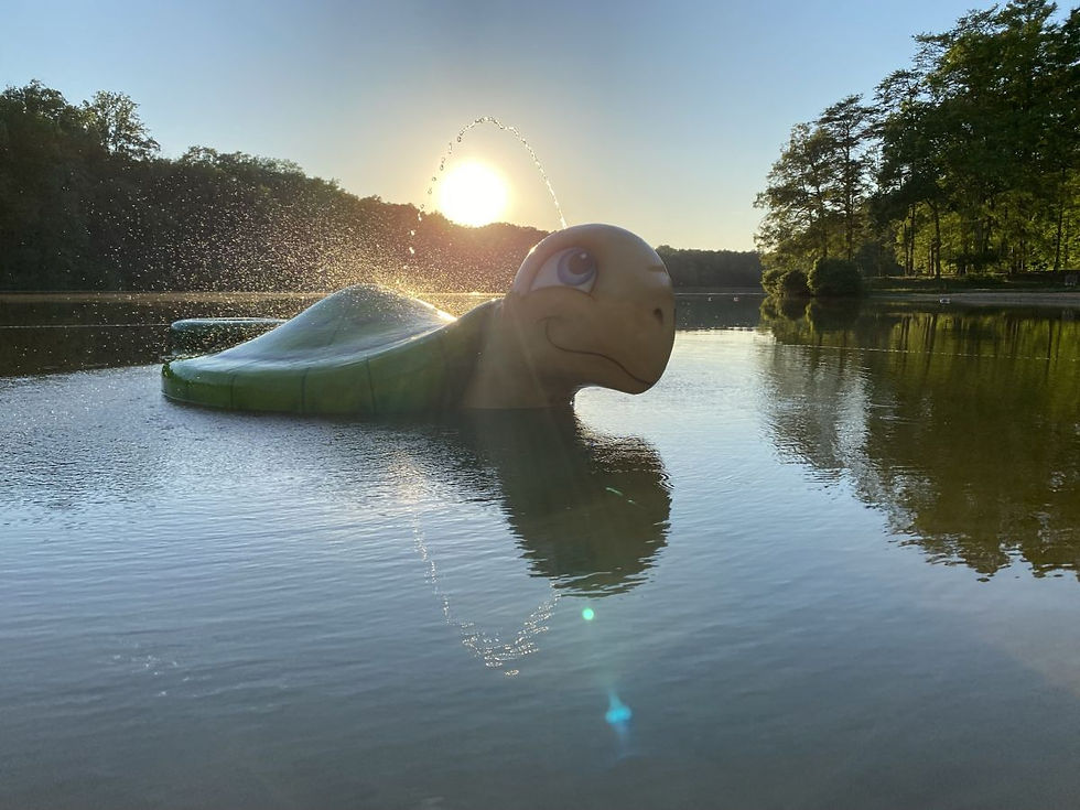
The swimming beach on the lake was very popular during the day with moms with young children swimming in the protected area and teenagers launching paddleboards and kayaks from the edge. The lake itself was very poplar with people fishing both from the banks and from kayaks and jon boats on the lake itself. I hiked a number of the park trails, many of which go along the edge of the lake. And I also kayaked in the lake on a calm, early morning.
About 20 minutes to the west area a couple of Wildlife Management Areas. The Virginia Department of Wildlife Resources (DWR) maintains Wildlife Management Areas (WMAs) for a variety of outdoor recreational opportunities. Many management areas are open for hunting. These lands are purchased and maintained with hunting, fishing, and trapping license fees. Amelia Wildlife Management Area, which is 2,217 acres in size, is primarily upland habitat with approximately 175 acres of bottomland hardwoods and beaver swamps along the Appomattox River. I kayaked in the small lake there. There were several people out fishing on and around the lake. I also hiked around the 4462 acre Powhatan Wildlife Management Area which has old fields now cultivated areas for habitat enhancement, wood lots, and fishing lakes which provide for a diversity of wildlife species.
About 30 miles north of the park is Toiter Creek Reservoir Park, a 209 acre park in Albemarle County. It has fishing and hiking opportunities. The trail wraps along the edge of the reservoir before leading into the woods and up the small mountain slope.
I also hiked at Pleasant Grove Park in Fluvanna County. The park has a trail named Sandy Beach Trail leading to the scenic Rivanna River. The "beach" is actually made of river gravel (and not sand) but was very pretty. The park also has a very nice butterfly garden and a large community garden.
I visited James Monroe’s Highland (formerly known as Ash Lawn) which is a historic site with a new story to tell. America’s fifth president lived at Highland sporadically from 1799 to 1823. Monroe sold the house and the fields immediately surrounding it in 1826, and the Bank of the United States sold the remaining farmland in 1828. The history of Highland includes James Monroe, his wife Elizabeth Kortright Monroe, and their family, as well as many enslaved men, women, and children. Between the untold stories of enslaved people, a fire that destroyed the main residence, and property changes by later owners, mystery and misunderstanding surrounded the site for years. Only now are historians and archaeologists peeling back the layers of history to uncover Highland’s complete past. The Monroes’ original residence, built in 1799, burned down around the mid-1800s. Later owners contributed the name “Ash Lawn,” which was linked to the property’s name for more than a century. In 2016 it reverted to its name given by the Monroes. In 2016, a research discovery was announced that transformed the understanding of Highland and of Monroe himself. Archaeological work uncovered remains from the 1799 main house, preserved just below the ground’s surface. The archaeological research continues, with more excavations planned for the future. In fact, there is current archeological work happening at the site and the researchers were happy to explain their work and their findings. The main house is not current open for tours while the staff works through the COVID protocols for keeping everyone safe, but the grounds and outbuildings are open and have interpretive signage. The grounds feature some spectacular gardens and nicely landscaped beds.
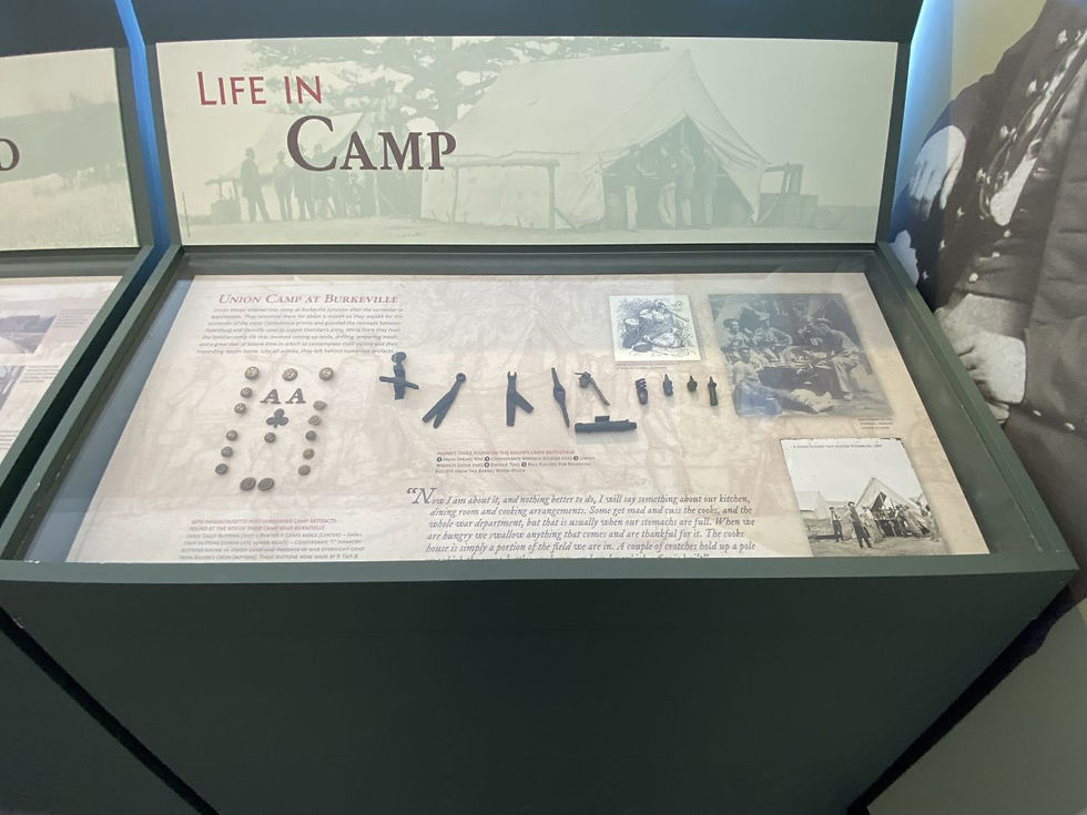
I drove about 25 miles south from the campground to Sailor's Creek Battlefield State Park. The site is important because just before the surrender at Appomattox that would signal the end of the Civil War fighting in Virginia Confederate General Robert E Lee’s army trudged its way through Amelia County in hopes of reaching greatly needed supplies at Farmville. At Sailor’s Creek, Union General Ulysses S. Grant’s forces successfully cut off the line of retreat and attacked the rear guard. The result was an overwhelming Union victory, having captured wagons, artillery, approximately 7,700 combatants, and 8 Confederate generals. 72 hours later, General Lee would be surrendering the remainder of his army to General Grant at the village of Appomattox Court House, thus effectively ending the fighting in Virginia.
The site has a very nice museum with very well interpreted exhibits and also a driving tour that has several sites on Lee's Retreat. Along the driving tour is the Overton-Hillsman House, which was used as a field hospital during and after the battle. The small farmhouse was built around 1780-1810 by Moses Overton. About 358 Union and 161 Confederate soldiers were treated here, on its lawn and in the house. In 1985, The U.S. Department of Interior, designated Sailor’s Creek Battlefield a National Historic Landmark.
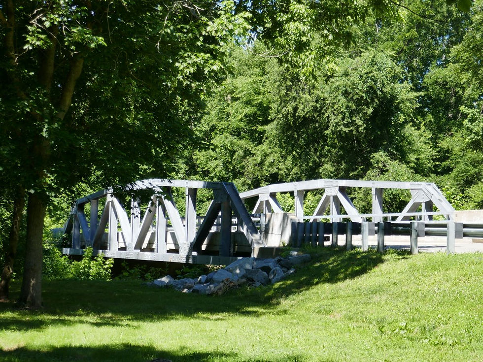
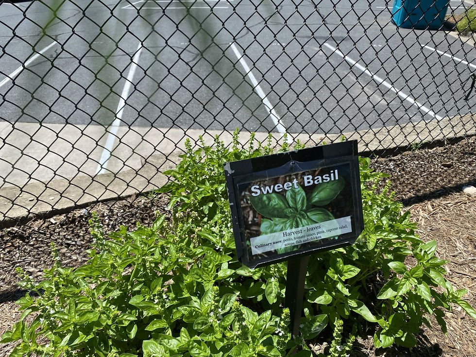
After visiting Sailor's Creek, I drove to the nearby High Bridge State Park in Farmville. High Bridge Trail is 31 miles long and can be accessed for for hiking, bicycling, and horseback riding. The trail is a former railroad track donated to the state in 2006 for establishment of a new state park. The trail is wide, level and generally flat. The park’s centerpiece is the High Bridge, which is more than 2,400 feet long and 125 feet above the Appomattox River. It is the longest recreational bridge in Virginia and among the longest in the United States. High Bridge, a Virginia Historic Landmark, is on the National Register of Historic Places. I brought my bicycle and rode about 16 miles of the trail from Camp Paradise through the town of Farmville. Along the trail was this really cool herb garden that encouraged people to help maintain the garden but also to take a sprig or two of the herbs.
Within the Cumberland State Forest, I came across this (somewhat scary) pedestrian swinging bridge at the end of a gravel forest road. It wasn't exactly in disrepair, but I'm still surprised that the state officials have allowed it to remain on state property.
This was a great trip and i was able to see and discover lots of stuff that I didn't know aobut before.
Campsite Details
Site A16 - $35/night
Checkin Time 4:00 PM
Checkout Time 1:00 PM
Electricity Hookup 20, 30 amp
Water Hookup - Yes
Maximum Number of People 6
Pets Allowed - Yes
Max Number of Vehicles - 2
Driveway Surface - Gravel
Driveway Entry - Back In
Max Vehicle Length - 20
Partial Shade
Site Length - 33
Site Width - 13
Tent Pad - Yes
Tent Pad Length - 16
Tent Pad Width - 12
Campfire Allowed - Yes
Fire Pit - Yes
Picnic Table - Yes
Proximity to Bathhouse - 282
Latitude, 37.531773. Longitude, -78.271589
Park and Campground Images


Amelia and Powhatan WMAs


Toiter Creek Reservoir Park


Pleasant Grove Park


James Monroe's Highland


Sailor's Creek Battlefield State Park


High Bridge Trail


Kayaking in Bear Creek Lake


Pedestrian Swinging Bridge


Scenes along the Drive


