Camping - Fairy Stone State Park - Stuart, Virginia - May 2021
Leading into this week, we experienced the impacts of the cyberhack of the the Colonial Pipeline and the aftereffects of people panic-buying gasoline leading to gas stations across the state running out of gas for several days. i wasn't sure if the fuel operations were going to resume before my trip and if I might have to cancel or delay my travels. Thankfully, the pipeline resumed and the fuel distribution gradually caught up with the demand allowing me to keep my plans intact.
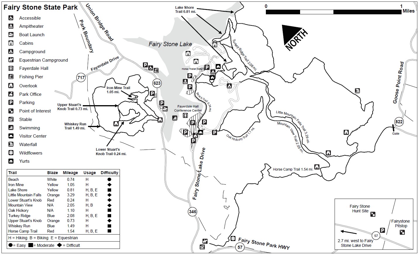
I stayed at Fairy Stone State Park which is located is in Stuart, Virginia (near Martinsville). The park is about 265 miles (5 hours) directly due west from Hampton Roads. It is in the foothills of the Blue Ridge Mountains. Fairy Stone State Park is one of the six original Virginia state parks and opened in June 1936. It was constructed with assistance from the Civilian Conservation Corps (CCC). The park was listed as a historic district on the National Register of Historic Places in April 2007.
www.dcr.virginia.gov/state-parks/fairy-stone
This park is home of the legendary fairy stones, is 4537 acres in size, and contains the 168 acre Fairy Stone Lake which spills into Philpott Reservoir. The park has cabins, a campground (with a separate equestrian campground), a conference center, hiking trails, lake activities including a swimming area and beach and rentals of rowboats, paddleboats, and kayaks, picnicking and two playgrounds.
The campground has 56 campsites. I stayed in space number 8 which is a paved, back-in site. (You can see the specific details about the site below.) All the sites have water and electric hookups at the site. The campground has a dump station near the exit. This campsite was narrow but deep. The narrowness was caused by several trees which made it challenging to get the camper into the site while still allowing the slide and awning to be extended.
I went hunting for fairy stones!! The park is famous for these special stones. Fairy stones are Staurolite crystals are found in only a few places around the world. The crystals form into little “bricks” that, under pressure, twist in 60 degree or 90 degree angles, forming crosses. For the geeks out there, the chemical composition is Fe2+2Al9O6(SiO4)4(O,OH)2 (So they contain iron, aluminum, and silicon in addition to oxygen and hydrogen.)
To find the fairy stones, you park at a little store down the road from the park entrance and access a trail behind the store. The fairy stones are pushed to the surface with the uplift of the mountains forming. And since they are harder than the surrounding soil, they get exposed on the surface. The fairy stones were elusive ... I did see a lot of gravel wash (You aren't supposed to dig, so I respected that rule. There was evidence of others not adhering to this.) ... but I was able to purchase some at the park gift shop. They definitely are very cool.
I hiked within the park which as numerous trails. Stuart’s Knob (a small mountain within Fairy Stone State Park) was the site of an iron mining operation from the late-1700’s to the early 1900s. This hill was mined with picks and shovels for over 100 years. There are overlooks on the mountain that provide views of the Fairy Stone Park beach and other mountains. Despite the rain, it was a nice hike. I also hiked from the campground along a trail leading to Little Mountain waterfall. The trail was marked on the map as "strenuous" so I was a little concerned heading in. The trail ended up not being too steep (except in a few places), but I did have to cross through the water in the creek in several places. But the water wasn't running very fast, so the crossings were easy. But this is why I bring multiple pairs of hiking shoes with me. My shoes definitely got wet.
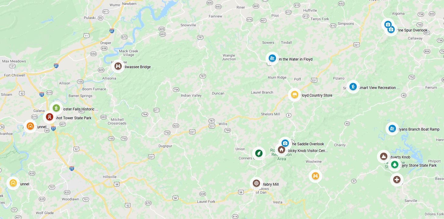
I drove up onto the Blue Ridge Parkway. The Parkway (which is completely free to access) is managed by the National Park Service and spans 469 miles in North Carolina and Virginia. The Virginia part, which begins at the north end at Shenandoah National Park, is 217 miles long. I entered the Parkway at mile 176 (Meadows of Dan) which is where the famous Mabry Mill is located. The site has a gristmill, waterwheel, and water supply flume system. The National Park Service acquired the Mabry Mill property in 1938. The gristmill complex and the blacksmith and wheelwright shop were deemed historically significant by the Park Service as representing the rich cultural past of the Blue Ridge Mountain region. In 1942 those structures were completely restored. Mabry Mill is one of the most photographed sites on the Blue Ridge Parkway.
Driving north on the Parkway from there, I checked out Rocky Knob Recreation Area (Milepost 167), Saddle Overlook, Smart View Recreation Area (Milepost 154.5), Pine Spur Overlook, Devils Backbone Overlook. Beyond that point between Milepost 135.9 and Milepost 121.4, the entire Parkway was closed due to a full road failure near milepost 128 due to heavy rains. The repair is expected to take at least 12 months.
On the way up to the Parkway, I stopped by Jack's Creek Covered Bridge. The 48 foot long bridge was built in 1914 and is constructed of oak. The bridge was listed on the National Register of Historic Places in 1973. It was fully restored by the Virginia Department of Highways in 1974. It is the only historic covered bridge remaining in Patrick County and is maintained by the Patrick County government. The other covered bridge that had existed near by (Bob White Covered Bridge) was washed by a flood in 2015.
When you visit this part of Virginia, a trip to the town of Floyd (0.5 square miles in area) is a must do. The Floyd Country Store is renowned as a place to experience authentic Appalachian music. The store is one of the major venues along the Crooked Road Trail, Southwest Virginia's Heritage Music Trail. In the 1980s, folks in Floyd started coming out to the General Store to listen to the owners' bluegrass band practicing and thus began the Friday Night Jamboree tradition that continues today. The Floyd Country Store is a real country store that is over 100 years old. As you might expect, the store has the barrels of old-fashioned candy at the front of the store. They also have everything from hand-dipped ice cream to clothing and a collection of hard-to-find CDs and music accessories. Everything in Floyd is music and art related or otherwise funky. I had lunch at this place that was a combination of a shack on a trailer and a yurt and an old school bus.
I drove a few miles north of the town of Floyd local outfitter called On the Water in Floyd. They have kayaking and tubing (although the water is still a bit cool for tubing). The launch is right at their property. They provide all the needed equipment and allow you to paddle at your own pace. They then come and pick you up and provide transportation back to the launch. I kayaked about 4.9 miles down the river (although this part flows north). I had the river all to myself other than a pair of Canada geese who led the way down the river and group of ducklings paddling around the edge. It's cool to kayak in these mountain rivers with the edges and bottom lined with huge rocks.
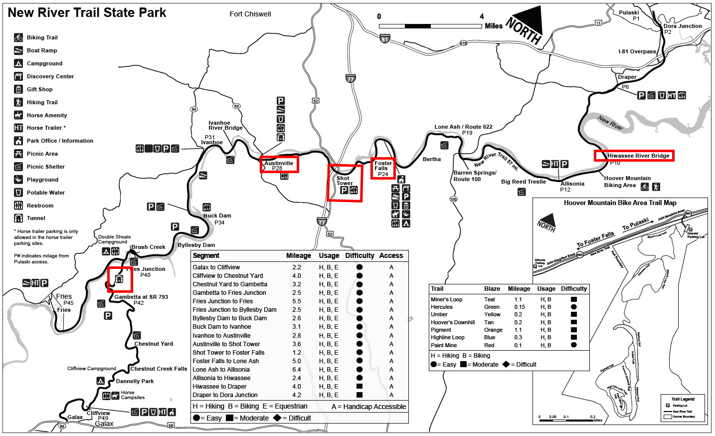
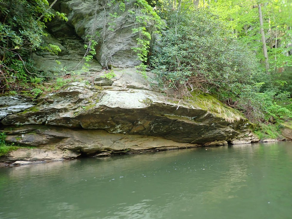
About 60 miles west of the Fairy Stone is New River Trail State Park. This park is a linear park that follows an abandoned railroad right-of-way. The trail runs along the New River for 39 miles. The trail is open for hiking, biking, and horseback riding. The park came into existence through a donation of the abandoned railroad right-of-way to the State of Virginia from the Norfolk Southern Corporation. The park opened to the public in May 1987 with four miles of trail. Since then, approximately 57 miles of the park have been opened to the public. There are several trestles and bridges including Hiwassee Bridge (which is 951 feet in length and was my first stop). There also are two tunnels one near Austinville and one near Fries. I hiked along the trail checking out the beautiful scenery on the river. Near the second tunnel, I came across a series of magnificent water cascades on the rocks of the river. The Foster Falls area is the headquarters for the park. The Foster Falls village was established as a result of the iron industry that flourished in the New River Valley during the 19th and early 20th centuries. The Foster Falls Mining and Manufacturing Company constructed the iron furnace 1881. This same company built the Foster Falls Hotel. The New River Trail and Foster Falls Historic Districts were listed on the National Register of Historic Places in 2009. The hotel is being renovated as a hospitality center and interpretive area.
Contained along the New River Trail is Shot Tower State Park. The Jackson Ferry Shot Tower was built in 1907 to make ammunition for the firearms of the early settlers. It is one of the few remaining shot towers in the country. This shot tower has a unique construction. Since it was built on the edge of a cliff, it is only 75 feet tall and the remaining 75 feet needed to form the properly shaped shot was dug as a shaft into the ground. Lead from the nearby mines was melted in a kettle atop the tower and poured through a sieve, falling through the tower and the shaft beneath the tower into a kettle of water. The walls of the tower are 2.5 feet thick. The tower was listed is on the National Register of Historic Places in 1969. In the parking area, there was a section with cones around it. Upon closer investigation, I discovered a killdeer who had laid eggs in the gravel (which is typical for the bird).
I also went kayaking in the lake at Fairy Stone and in the adjacent Philpott Reservoir. The waters were very clear and appeared almost emerald green when calm.
On my last day, I went on an adventure at Buffalo Mountain Zip Lines. They have a course that goes through the trees and features 8 zip lines ranging in lengths of 250' to over 2000' and heights of up to 150' above the forest floor and connected by suspended and ground platforms. The course was professionally engineered and meets all industry safety standards. The staff was great and ensured that we were completely safe the whole time but also ensuring that we had fun. What a blast!! Great views of the surrounding forest.
Campsite Details
Site 08 - $35/night
Checkin Time 4:00 PM
Checkout Time 1:00 PM
Electricity Hookup 30 -50
Water Hookup - Yes
Maximum Number of People 6
Pets Allowed - Yes
Max Number of Vehicles - 2
Driveway Surface - Asphalt
Driveway Entry - Back In
Max Vehicle Length - 35
Partial Shade
Site Length - 68
Site Width - 11
Tent Pad - Yes
Tent Pad Length - 16
Tent Pad Width - 22
Campfire Allowed - Yes
Fire Pit - Yes
Picnic Table - Yes
Proximity to Bathhouse - 60
Latitude, 36.784393. Longitude, -80.093717


Zip Lining