Camping - Smith Mountain Lake State Park - Bedford, Virginia - October 2021
I stay for a week at Smith Mountain Lake State Park. The park is in Bedford County, Virignia and is about 240 miles (4.5 hours) northwest of Hampton Roads and is in the foothills of the Blue Ridge Parkway.
Smith Mountain Lake is the second largest freshwater lake in the state and the largest lake that is totally contained in Virginia. The lake and the park are host to numerous water activities, including swimming, boating, fishing, picnicking, hiking on trails, and camping.
Smith Mountain Lake was created in 1960 when Appalachian Power built a dam on the Roanoke River in Smith Mountain Gap. Construction of the dam was completed in 1966, and in 1967 Appalachian Power donated the first parcel of park's land for the proposed park. The state bought the rest of the park's land over the next six years, and the park opened to the public in 1983.
The site I stayed in was site #37. It is a back-in gravel site. The RV sites in this campground were, for the most part, extremely large and well spaced. I had tons on space on the site for the camper and my truck and all of my setup. The campground host was very friendly and came back almost daily to check in. The park has a very busy boat ramp with many boaters going out fishing every day. The park has a created swimming beach, which was closed for the season, but was quite large.
https://www.dcr.virginia.gov/state-parks/smith-mountain-lake
Smith Mountain Dam is a concrete arch dam similar in construction to the Hoover Dam. The dam produces pumped-storage hydroelectricity.
I visited Poplar Forest which was Thomas Jefferson's retreat about 90 miles south of Monticello. Jefferson inherited 4,819 acres of land and 11 enslaved men, women, and children at Poplar Forest through his father-in-law in 1773. The property’s name, which predates Jefferson’s ownership, reflects the forest that once grew here. Several stately poplars are still located in the front of the home. The structure is a octagon and has two large bedrooms on the main floor along with two smaller rooms that were used for various purposes, a dining room, and a parlor. The privy's were, of course, located in separate small structures located a distance from the house. And the kitchen and cellar were located on the lower level. Today, the private foundation which runs the site is restoring parts of the inside of the house. They are committed to using the same tools and methods that would have been used in the original construction, so they have a series of hand tools including planes, scribes, and scrapers to cut and shape the various parts. So parts of the house have the walls exposed to show the construction.
I also visited the National D-Day Memorial which is located in Bedford. Local residents who participated in the war where known as "The Bedford Boys" and one of them was instrumental in the creation of the memorial. The memorial was created and operates solely with private funding. The memorial does a great job of interpreting and displaying the events that led up to and occurred on June 6th, 1944 on the beach at Normandy. The memorial was dedicated on June 6th, 2001.
The Booker T. Washington National Monument commemorates the birthplace of America's most prominent African American educator and orator of the late nineteenth and early twentieth centuries. The property evokes an 1850s middle class tobacco farm, representative of Booker T. Washington's enslaved childhood at the Burroughs farm. He was born in 1856 to the Burroughs' cook and lived on the farm throughout the Civil War. The Burroughses were an upper middle class family. The farm produced tobacco as a cash crop and grew other subsistence crops like flax, potatoes, and grains for family sustenance. Booker T. Washington lived in the farm's one-room kitchen cabin with his mother and two half siblings. As a small child he brought water to the men in the fields, carried the books of the Burroughs' daughters books to school, and transported grain to the local mill.
I drove along the Blue Ridge Parkway stopping at many of the overlooks. The fall colors in Virginia were a bit delayed this year, but there were some places where the color was starting to turn. I visited Sharp Top Mountain which can be accessed via a 1.5 mile, very steep trail or by taking a shuttle to a point near the top and hiking the rest of the way on a narrow and still very step trail. It was long thought to be Virginia’s tallest mountain, when in fact, it is not even the tallest of the Peaks of Otter. Nearby Flat Top rises to 4,001 feet. Mount Rogers near the North Carolina border is the state’s tallest mountain at 5,729 feet. The views from the top of Sharp Top are spectacular.
The tourism slogan for Virginia is "Virginia is For Lovers". The tourism agency has a program where local governments, agencies, and business create art, typically in the form of a sculpture using L-O-V-E and typically incorporating a theme appropriate to the location. These are called LOVEworks. There were several of them in the area around Smith Mountain Lake. https://www.virginia.org/love/
I visited Dixie Caverns, which is a privately owned "show cavern" located near Salem, Virginia. The caverns were found by a couple farm boys back in 1920 after their dog fell through a hole that led to the caves. They decided to name the caverns after their dog in honor of his discovery. Guided tours of the caverns were begun in 1923. Unlike many caverns that are located below the surrounding ground, these caverns actually go up into the mountain in which they are located.
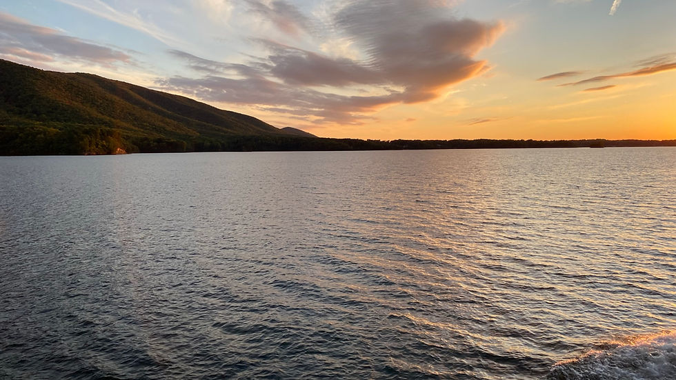
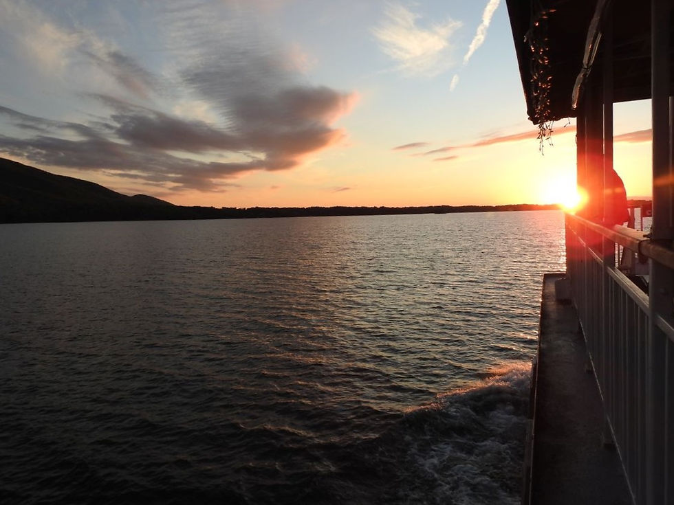
On my last night, I took a boat tour at sunset. The tour went by various sites on the lake including the dam and provided excellent views of the surrounding property from the water viewpoint.
I had a great week touring this area. So many interesting things to see and learn about. This is also my last camping trip of the year ... but I'm already planning for next year! Stay tuned!!
Campsite Details
Site 37 - $35/night
Checkin Time 4:00 PM
Checkout Time 1:00 PM
Electricity Hookup 30 -50
Water Hookup - Yes
Maximum Number of People 6
Pets Allowed - Yes
Max Number of Vehicles - 2
Driveway Surface - Gravel
Driveway Entry - Back In
Max Vehicle Length - 35
Full Shade
Site Length - 65
Site Width - 30
Tent Pad - Yes
Tent Pad Length - 16
Tent Pad Width - 22
Campfire Allowed - Yes
Fire Pit - Yes
Picnic Table - Yes
Proximity to Bathhouse - 270
Latitude, 37.079625 Longitude, -79.610993