Sunday, May 14, 2017 - Shingle Landing - Moyock, NC - Happy Mother's Day!
Well, the past three days have been rainy and cool. Happy Spring in Hampton Roads!! But the rain cleared and the temperature rose so I decided to go out for paddle on a Sunday. I got to talk to Lil Mommy before I went out and wish her a happy day!
I decided to check out Shingle Landing Creek which is just over the state line in Moyock, North Carolina. There is a small boat ramp with parking for about a dozen vehicles with their trailers. It's in the very back of a small residential neighborhood.
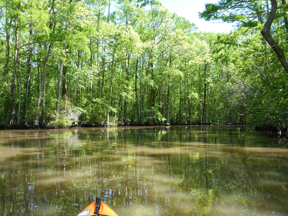
Shingle Creek is pretty narrow. It's only about 60 - 80 feet wide the whole way until it meets the Northwest River. This is perfect for paddling. (For comparison, the main river is about 375 - 400 feet wide.)
The creek is lined with trees the whole way. It's about a mile and a half paddle from the boat ramp to the confluence of the Northwest River. The creek is fairly winding so that makes for an interesting paddle. This area is part of the Northwest River Marsh Game Land Dedicated Nature Preserve in North Carolina. After you cross into Virginia, it is the Northwest River Natural Area Preserve.
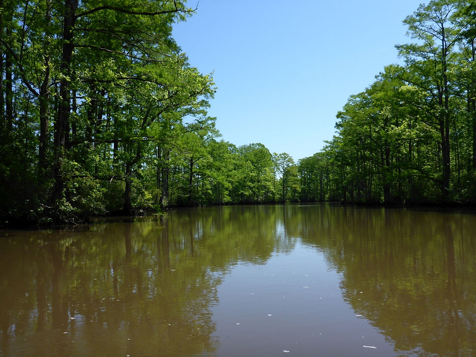
The water in Shingle Creek was pretty muddy looking. Most likely this is a result of all the rain we have had. Once I got to the confluence of the creek with the main river, there was a clearly defined line where the muddy water from the creek met the clear, darkly stained, brown water of the river.
Once on the main river, the wind was a lot more prevalent. But I kept to the edges and stayed away from the powerboats. My goal was to make it to the state line and then see how I felt about going further at that point. It's about a 2.5 mile paddle from the boat ramp to the state line. The wind was from the west so I knew that I would be paddling into it on the way back. But luckily since the creek was so protected, it wasn't an issue. At the state line, there is a marker in the middle of the river indicating the border. I went a little further down a creek to the east. It was really pretty and very calm. And the water was incredibly clear.
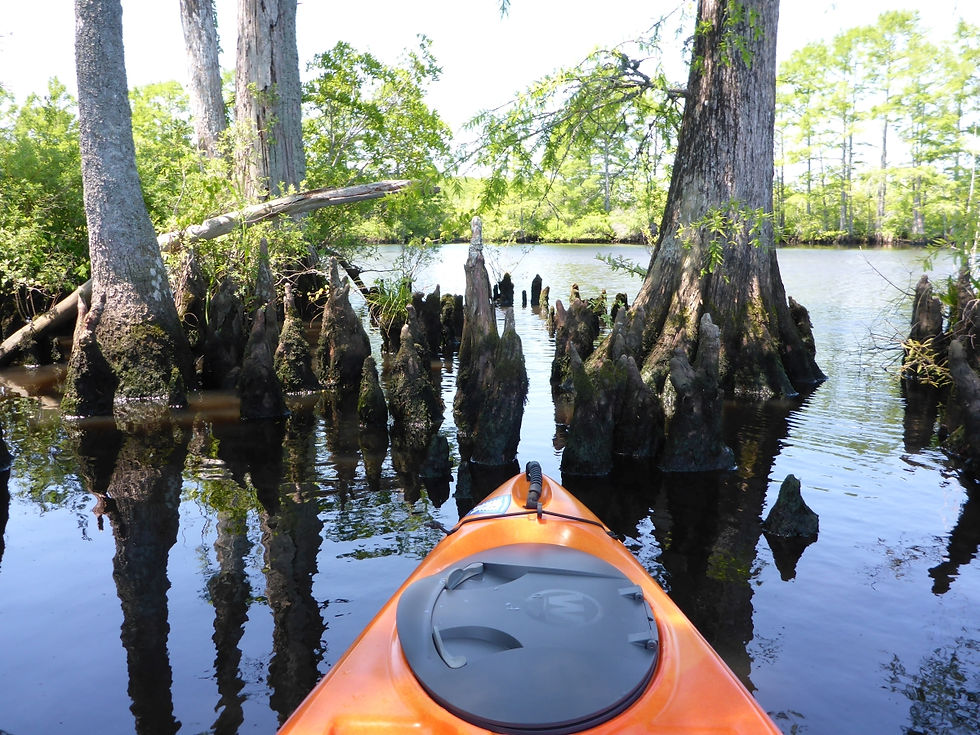
On the way back, I went down a different creek and looped around through the marsh. This was a much smaller creek, but was very paddleable. (Is that a word?) This was a great paddle. You never know when you go to a new place what exactly you will find. This one was better than I expected. I thought that maybe the tree cover would make it feel closed in, but it was open overhead the whole way. But still protected. Definitely a place to come back to. The weather was great. Upper 70s to 80 degrees. Sunny. Clear blue sky. Just a sli
I probably paddled further than I should have so early in the season and on a Sunday without a day to recover before going back to work, but so far I feel good and it was definitely worth it.
3 hours and 37 minutes on the water and 6.5 miles on the GPS. Scroll below the pictures to see the track map.
Edit: Here's a link to the GoPro video.